Faro Maps and Orientation
(Faro, Algarve, Portugal)
The Portuguese city of Faro lies within the Algarve region and near to the Ria Formosa lagoon, where is has become the proud capital. Faro can be found on the southerly side of Portugal and is currently home to a population of roughly 60,000 people.
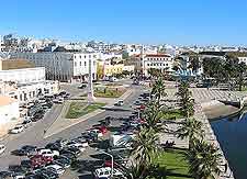
A particularly historic city, the oldest part of Faro still remaining in a good state of repair is known as the Cidade Velha (Old City), which stands directly opposite the harbour. The Cidade Velha comprises a large oval of cobblestone alleys and streets, flanked with brightly coloured houses and stone walls.
Maps and Orientation of the City
The Arco da Vila gateway marks the official entrance into the Cidade Velha area of Faro and is sited next to the turismo office, on the corner of the Rue da Misericordia and the Rua do Municipio, where good city maps can be obtained. The Rua do Municipio is a particularly important street and connects a number of leading attractions, such as the orange-tree lined Largo da Sé plaza, Faro's magnificent cathedral and the Bishop's Palace.
- Albufeira - 45 km / 28 miles (40 minutes, west)
- Alte - 55 km / 34 miles (45 minutes, north-west)
- Alvor - 75 km / 47 miles (one hour, west)
- Castro Verde - 104 km / 65 miles (one hour and 15 minutes, north)
- Lagos - 89 km / 55 miles (one hour and five minutes, west)
- Lisbon (Lisboa) - 277 km / 172 miles (two hours and 45 minutes, north-west)
- Loule - 20 km / 12 miles (25 minutes, north)
- Odemira - 120 km / 75 miles (one hour and 45 minutes, north-west)
- Olhao - 10 km / 6 miles (15 minutes, east)
- Portimao - 70 km / 43 miles (55 minutes, west)
- Porto - 556 km / 345 miles (five hours and 30 minutes, north)
- Sagres - 118 km / 73 miles (one hour and 25 minutes, west)
- Santiago do Cacem - 172 km / 107 miles (two hours and five minutes, north-west)
- Serra de Monchique - 90 km / 56 miles (one hour and ten, north-west)
- Silves - 62 km / 39 miles (50 minutes, north-west)
- Sintra - 300 km / 186 miles (three hours and five minutes, north-west)
- Tavira - 38 km / 24 miles (35 minutes, north-east)
- Torres Vedras - 314 km / 195 miles (three hours and 15 minutes, north-west)
- Cadiz (Spain) - 320 km / 199 miles (three hours and 15 minutes, south-east)
- Huelva (Spain) - 112 km / 70 miles (one hour and 20 minutes, east)
- Seville (Spain) - 197 km / 122 miles (two hours, east)
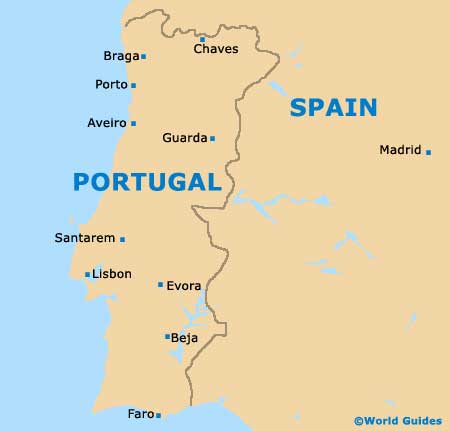
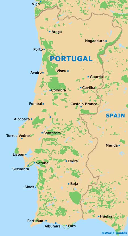
Map of Portugal
Map of Faro

